|
Simple antennas with poor directionality transmit significant power
off-nadir, and therefore can receive significant reflections from
off-nadir topography. These off-nadir reflections can arrive at a
similar travel time to reflections from the nadir subsurface, and
therefore be misinterpreted as originating in the subsurface. One
way to confront this uncertainty is to model the radar reflections
expected from topography and compare the result to observed data.
This allows an interpreter to rule out candidate subsurface
reflections that coincide with modeled topographic reflections.
As an undergraduate at the University of Texas I re-implemented
an existing algorithm
for modeling radar reflections from a surface. While I was research
staff at the University of Arizona I led the generation of a dataset
of topography reflection models (a.k.a. surface clutter simulations)
corresponding to data products generated by the Shallow Radar
(SHARAD) instrument onboard the Mars Reconaissance Orbiter.
This dataset
was delivered to NASA's Planetary Data System and is intended to be
a resource for users of SHARAD data.
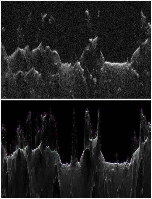
The image to the left shows SHARAD data (top) and the corresponding
clutter simulation (bottom).
|